To contact us Click
HERE

This was the view out our front window at Horse Creek Campground on Lake Kaweah. The Campground is run by the Army Corps of Engineers and is situated at the upper end of the lake. Normal lake level at this time of year is very near the high water mark across the valley in this photo. We normally could not park in this spot as the road to get this spot would be impassable.

Above is the marina at the dam of the lake. Below is looking up the lake towards Horse Creek.


The lake during normal rain/snow fall in the mountains to the west is nearly full by the end of February. But obviously precipitation has been lacking this winter. This will have an impact on the agriculture in the valley below stretching to Visalia, CA. The farmers rely on the water from the lake to supply the many canals and irrigation ditches to water their crops and citrus for the summer. That will be a real challenge this year, unless more rain/snow falls soon.

Snapped this pic of a woodpecker just outside our MH window. Not sure what kind it is however. It seemed to think that there were bugs in the logs of the office building.


We took a side trip into town (Visalia) one morning and snapped a photo of a mural dedicated to the Viet Nam veterans. There were several murals in town on different buildings dedicated to veterans of other conflicts & wars our men & women have been engaged in. Nice touch by the City Fathers to allow such memorials. Below was some sort of flower resembling a rose that was in the little plaza where this mural was located.


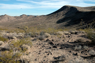
Above & below are photos from our campsite in Mojave National Preserve. The campground was called Hole In The Wall and was 20 miles off I-10 about 50 miles east of Barstow, CA. The campground was remote and windy. The location was right in the middle of a canyon, and for anyone who has camped between two mountains, understands the "canyon effect" wind currents. We could hardly spend time outside the MH while there.


We took a little Jeep ride on the Macedonia Canyon Road (dirt/gravel) and these pics were snapped along the way.


On the dirt road we came up on this old remnant of a homestead from long ago. Possibly Native American, as this area was settled by the local tribes long before any intrusion from the European migration to the west.

A jack rabbit below. They are all over the place, as is mule deer and Gambel's Quail.


The next day we drove the Jeep down I-10 to US-95, about 25 miles west of Needles, and went north to the Mojave Road. From Wiki:
The Mojave Road or Mojave Trail is a historic route and present day four-wheel drive road across what is now the Mojave National Preserve in the Mojave Desert. A traditional thoroughfare of desert-dwelling Native Americans, the road much later served Spanish missionaries, explorers, and foreign colonizers and settlers from the 18th to 19th centuries, and ran between watering holes across the Mojave Desert between the Colorado River and San Bernardino Mountains in Southern California. Below, a rest stop as we just finished the climb out of the canyon from US-95 entrance onto the Mojave Road. It was about 10 miles so far from US95.
 Above, the Road looking west and into the National Preserve. Below, we stopped for lunch near an old coral, in the proximity of the former Fort Paiute. We looked every where for the ruins/remnants of the Fort, but never found them. The Preserve map we used to get here indicated this was where it was, but we sure didn't see anything. Oh well!
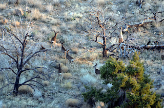
 On the way back to the MH and some 40 miles across the Preserve via the Mojave Road we snapped a pic of these mule deer. The Jeep is sure a happy camper as she is just filthy and dusty. The way she likes to be. Miss Jeepy sure takes us to places where other vehicles can not. We sure like going off road.I must add here that we did go over to the Kelso Depot along the Union Pacific RR south of Cima, CA. Somehow Nancy's camera corrupted the pics she took of the Depot, and they were some neat pics. :-( From Wiki: The Kelso Depot, Restaurant and Employees Hotel or Kelso Depot, now also the Mojave National Preserve Visitors Center, is located in the Mojave Desert within the National Park Service Mojave National Preserve, on Kelbaker Road in Kelso, California. So, we left Mojave and drove to Yuma, via Havasu City. We are at the Yuma Proving Grounds (Army) Desert Sands FamCamp. We arrived here on Thursday 2/23 and will be here far a week. So, till our next blog, so long from the RVing Beach Bums.
Hiç yorum yok:
Yorum Gönder