These are a series of simple three-dimensional maps I created to provide a birds-eye-view of this deglaciated landscape while comparing a few of the open-source alternatives out there:
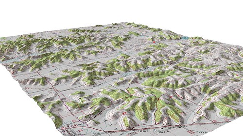
USGS DRG draped over 10-meter DEM - (Black Earth, Wisconsin)

An attempt at draping the same DRG over the same DEM - (Black Earth, Wisconsin)
The product out of ArcScene is visually more compelling than the NVIZ version, I still can't figure out why the DRG is so pixelated in NVIZ. NVIZ was accessed through the GUI-driven GRASS available in QGIS ('Copiapo'). What I do like about NVIZ (besides being open-source) is that you can actually add an arrow (easily) and scale bar (which isn't all that great) into the 3D scene (seriously ESRI, how long has it been?). The red point in all the scenes is where the photo was taken looking to the northwest.
I am in the midst of trying to create similar 3D images using CapaBuilder and IDV, but so far I haven't figured these two out!
Hiç yorum yok:
Yorum Gönder